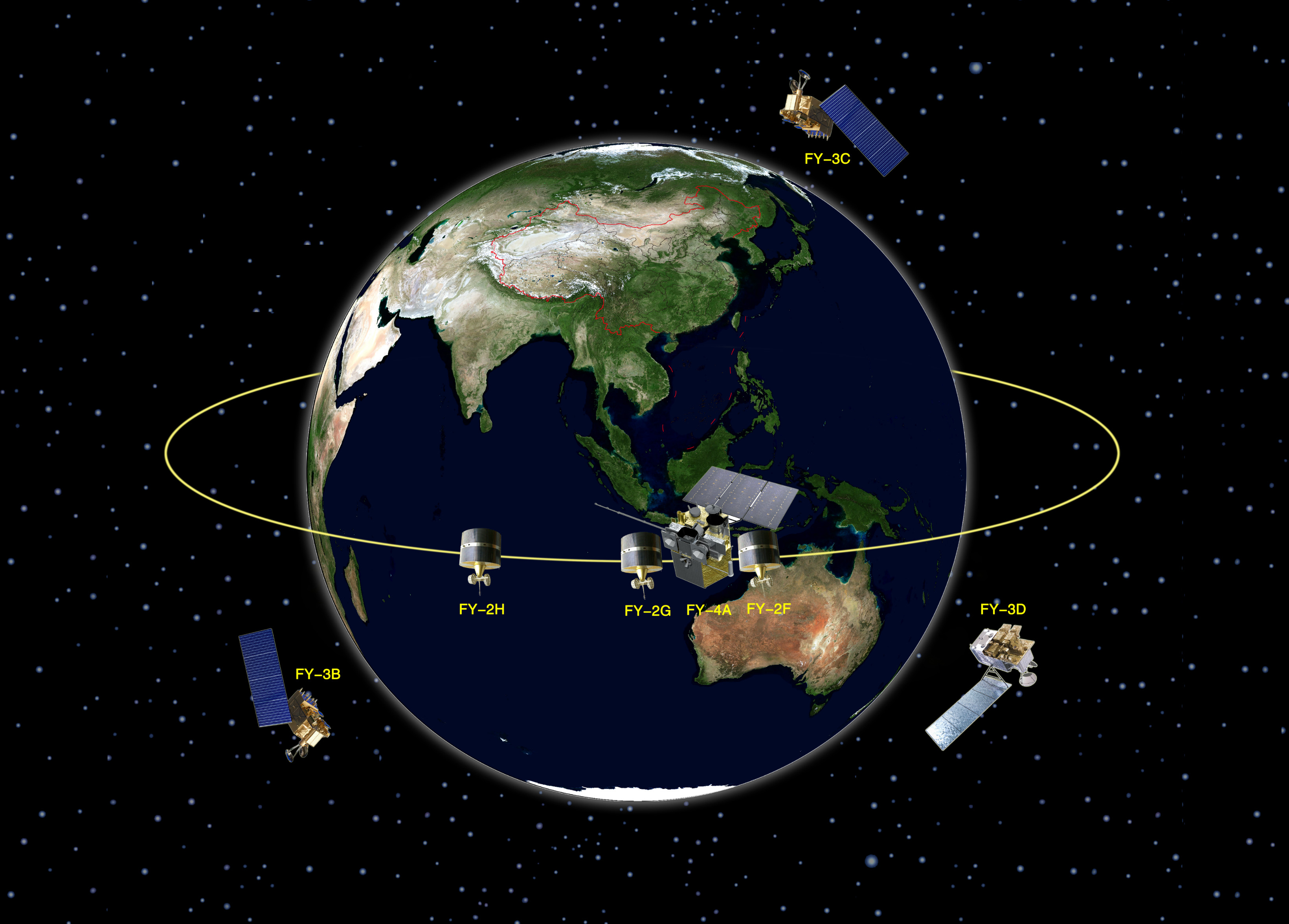
This year marks the 50th anniversary of China’s Fengyun Satellite Program. Up to now, China has launched 17 Fengyun meteorological satellites in total, with 7 in orbit. The Chinese meteorological satellites Fengyun, or FY in acronym, are arranged in series. The odd number series is the polar-orbiting satellite series, and the even number series is the geostationary ones.


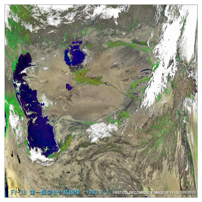
The first color composite image of FY-1B satellite
Polar-orbiting satellites
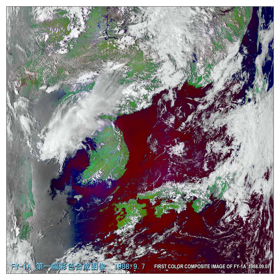
CMA started to develop its polar-orbiting meteorological satellites in the 1960s. FY-1 series are CMA's first-generation sun-synchronous orbiting meteorological satellites made in two groups. Each group has two satellites. FY-1A and FY-1B in the first group were launched on September 7, 1988 and September 3, 1990, respectively. FY-1C and FY-1D in the second group were separately launched on May 10, 1999 and May 15, 2002.
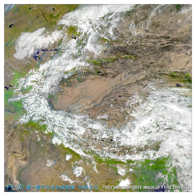
The first color composite image of FY-1C satellite
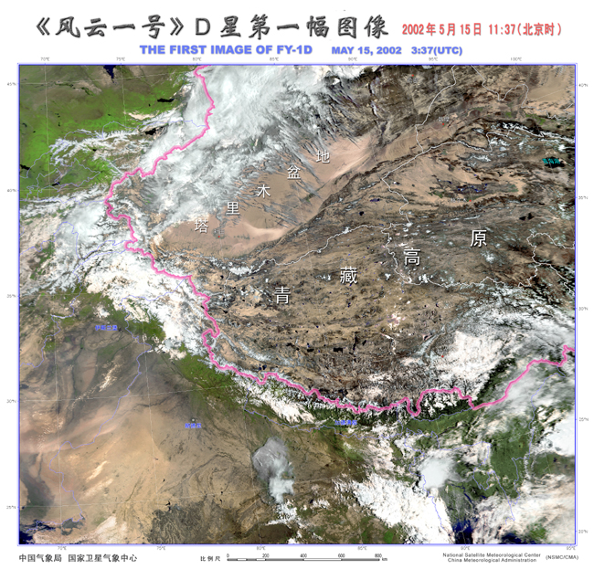
The first color composite image of FY-1D satellite
The satellites in the second group of FY-1 satellites are designed with an enhanced reliability of attitude control system and improved performance of scanning radiometer, with channel numbers increased from the original 5 to 10. The high resolution picture transmission (HRPT) rate is also doubled from 0.6654Mbps to 1.3308Mbps. The satellites are installed with a solid state memory device to achieve the delay image transmission (DPT). The improvements have greatly enhanced the satellites' performance, with their working life exceeding the 2-year design span.
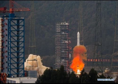
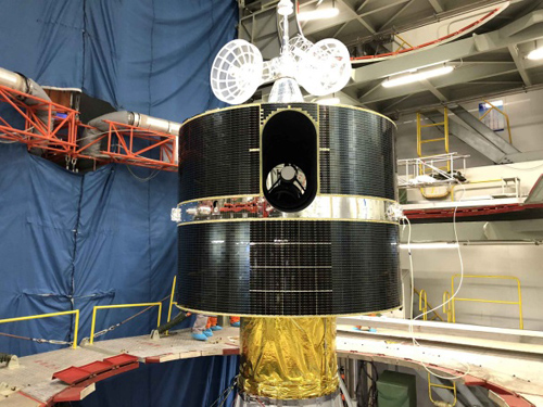
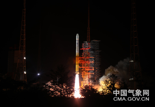
Geostationary meteorological satellites
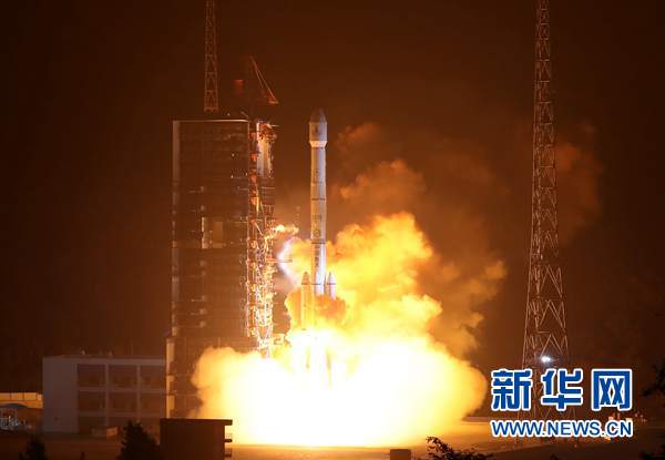
CMA started to develop its geostationary meteorological satellites and associated ground application systems from the 1980s. CMA launched its first geostationary meteorological satellite FY-2A satellite on June 10, 1997.
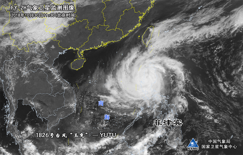
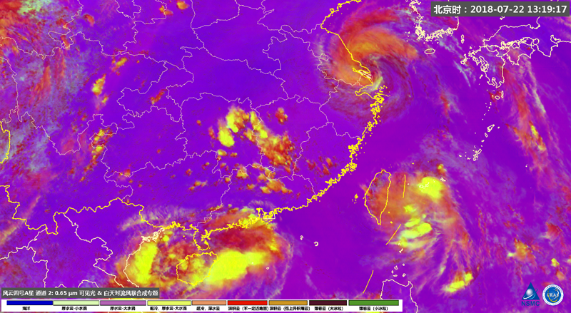

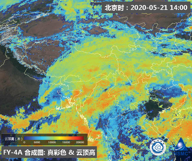
Monitoring image of typhoon Hagupit captured by FY-4A satellite in 2020
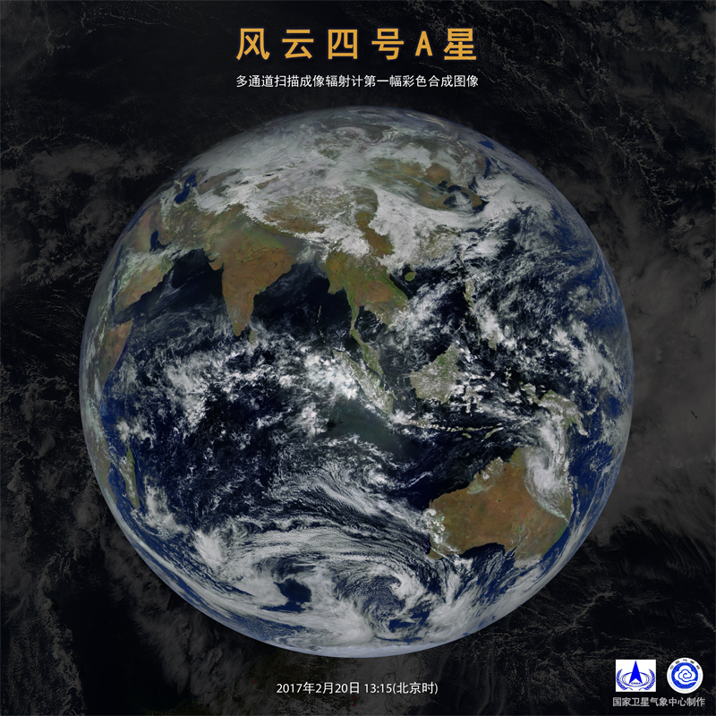
Advanced Geosynchronous Radiation Imager (AGRI) onboard FY-4A satellite has refined spatial resolution from 5 kilometers to 2 kilometers. Observation temporal resolution targeted at China and neighboring regions have been shortened from 30 minutes to 5 minutes. When required to meet specific observation demand, data can be transmitted in a shorter time. FY-4A satellite can provide myriad high spatial and temporal resolution observation information for monitoring the trend and intensity transition of typhoon, and weather system evolution in neighboring environmental field.
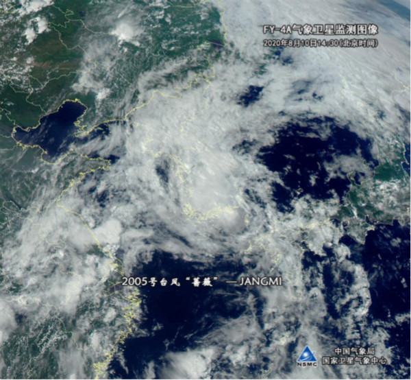
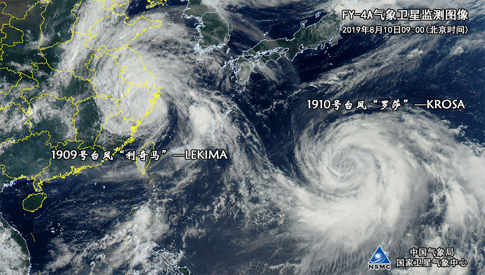
Monitoring image of typhoon Jangmi captured by FY-4A meteorological satellite in 2020
FY-4A satellite can also provide 500-meter high spatial and temporal resolution images, which reflect refined dynamic information like typhoon cloud structure and its evolution, especially the monitoring of typhoon eye area. In terms of environmental monitoring, FY-4A satellite has expanded the operation of haze monitoring. Ecological environmental team has conducted product development work of multiple image making and quantifiable monitoring. FY-4A identification accuracy of sand and dust has been markedly enhanced as well. The newly developed index product has played an active role in sand and dust monitoring.\
Since the beginning of 2017, CMA has developed the FY-4A products and data test application in the field of special and public meteorological services, and plans to establish new satellite products, including technical methods and operational systems towards solar energy resources observation and short-term forecast, highway road temperature monitoring, forest fire risk monitoring and forecasting, aviation meteorological services and lightning monitoring and early warning. Now, FY-4 satellite weather modification application demonstration project has also been fully launched, which has injected new vitality into the weather modification operation. FY-4 satellite macro-microscopic cloud feature parameters and weather modification clouds classification.
Fengyun satellites play an instrumental role in global observation and disaster preparedness
Chinese President Xi Jinpin expressed on a few international occasions that China will offer meteorological services to all parties through its Fengyun satellites, like Shanghai Cooperation Organization, Arab states, and African countries. CMA has taken many measures to implement relative programs and push ahead the development of Fengyun satellite.
A national satellite remote sensing application system composed of a national-level data processing and service center, 31 provincial application center, and over 2500 reception and application stations has been forged. Fengyun Meteorological Satellite System is one of the major components in the World Meteorological Organization (WMO)’s Space-based Observing System as well as the International Charter on Space and Major Disasters.
Currently, CMA is providing satellite data and over 100 products to more than 100 countries or territories by CMACast, direct broadcast receiving systems and the Internet. The Fengyun satellites has benefits 115 countries and territories. In 2019, the satellite data sharing services volume added up to 5.4 PB. CMA also provides intensive observation service as requested by launching Emergency Support Mechanism of FengYun Satellites.
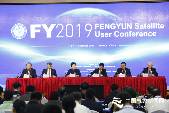
Fengyun satellite user conference in 2019
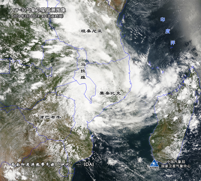
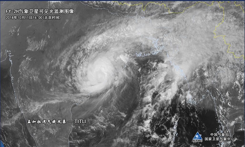
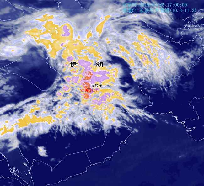
In 2019, CMA provided Fengyun satellite services for countries like Mozambique to cope with the severe flooding affected by tropical cyclone Idai. Confronted with the COVID-19, WMO has listed Fengyun satellite monitoring products as one of the major resources to help other countries elevate monitoring capacities of meteorological hazards, like the flooding in southern Iran, desert locust in Pakistan, and the cyclone storm in Bay of Bengal. Monitoring of disasters by Fengyun satellites have showcased China’s strong sense of assuming international responsibility.Fengyun meteorological satellite data acquisition services are provided to international users via CMACast, and the internet.

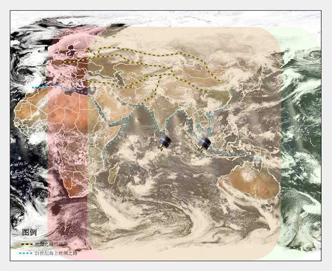
Right now, 25 neighboring countries and territories, like Indonesia, Thailand, Malaysia, Myanmar, Laos, Pakistan, and others have set up CMACast data reception stations, obtained Fengyun meteorological cloud images and products data. Those data have played their role in monitoring, tracking, and early warning of severe weather like typhoon, rainstorm, and sand and dust storm. CMA has also opened green data channel, developed tailor-made software and products, assisted the construction of direct receiving stations, organized training courses, and continued to provide custom-made services for users along “Belt and Road” territories.
On the strength of advanced technology caliber, stable and reliable operation, and high quality data products, Fengyun satellites, together with meteorological satellites from the United States and Europe, have become the main player in the global earth observation network, and shouldered the responsibility of carrying out all-weather, dimensional, and continuous observation of atmosphere, ocean and surface ground environment.
Editor: Liu Shuqiao